Saturday, November 29, 2008

Canyonlands National Park (Day 2)

Nov 17th, 2008 :- The Needles district is located about 65 miles South of Moab. As one approaches the area the first point to stop by is the Newspaper Rock that has ancient pertoglyphs. Such pictured rocks cannot be dated esily, neither do we really know the significance of these pictures.

As one comes closer to the entrance of the park ones comes across the North and South Sixshooter peaks that are shaped like pistols.

The Needles is a startling landscape of colorful sculptured rock spires, arches, canyons and potholes. The Needles are rock pinnacles carved in red and white. Chesler Park is a grassy meadow amidst the Needles and is a 3 mile hike (oneway) from Elephant Hill. The confluence of the Green and Colorado Rivers is located within this district but is only acessible by a 4.5 mile (oneway) hike or a short hike having approached closer along a 4*4 dirt road.

Short hikes at Cave Spring, Pothole point are easily accessible and provide a closer glimpse of the formations that might turn into Neeldes in the centuries to come.

I took the hike to Chesler Park to get closer to the Needles. It was however a lonely walk , and I turned around at the 1.75 mile mark having had a closer enough look of the Needles but did not get really close enough. The drive to Elephant Hill itself is along an unpaved road that has quite a few blind turns.

Canyonlands National Park (Day 1)

Nov 16, 2008 :- Canyonlands National Park is composed of three distinct districts "Island in the Sky", "The Needles" and "The Maze". The former two districts are easily accessible by paved road and are located to the North West and South West of Moab, UT respectively.

"Island in the Sky" is an area separated from the mainland by a small connecting ridge, about 40 m wide known as "The Neck". The Green River and the Colorado River converge in the park within the Needles district. The three districts are located between and around the two rivers separated by the rivers at the confluence.
The "Island in the Sky" district is about 35 miles from Moab. It is the observation deck of the park and provides expansive vistas from the Grand View Point Overlook. 1200 feet below one can see the White Rim a continuous sandstone beach. Another 1000 feet below lie the rivers shadowed by sheer cliffs. 17 miles of paved road take one to various observation points in the park in the "Island in the Sky" District. The Grand View Point Overlook provides a greater than 180 degree view of the White Rim, the Needles and the Maze. The Colorado river itself lies hidden beneath the White Rim amidst several nooks and turns of canyon land.

Shafer Canyon Overlook lies just beyond "The Neck" provides a first glimpse of the White Rim Road. It is 100 miles of unpaved road leading to the lower level along the White Rim.

The Mesa Arch lies just beyond Gray's Pasture, that streches for about 6 miles beyond "The Neck".

Whale Rock is a short walk by the road on the way towards Upheavel Dome. Upheavel Dome is a 1500 feet deep crater formed by slowmoving salt deposits that pushed sandstone upwards. There are two observation points here requiring a 1.6 mile hike to and fro to get to both points.


The Green River Overlook provides a view of the Green River in the distance that flows southwards to join the Colorado coming in from the North East.

Buck Canyon Overlook provides good views of the canyon formations above the White Rim.
Grand View Point Overlook is the place to be at sunset. A 1 mile trail along the rim provides good views Southwards and at one extreme towards the West. Closeby another 1.4 mile trail towards the West takes one down below to the White Rim.


Arches National Park (Day 2)

Nov 15, 2008 :- The day began with a briefing of the park at the Visitor Centre. The 15 minute orientation film seemed more informative, having been to some points of interest the previous day.

I then drove to the Windows Section that has a small concentration of Arches. The trails to these Arches were short easy walks. Turret Arch, North and South Windows and Double Arch are some of the arches one gets to see in this section.

Turret Arch:-


North Window :-


South Window:-


Double Arch :-


Lower and Upper Viewpoints of the Delicate Arch provide distant views of Delicate Arch.


Most of these arches are shaped so crisply that one wonders whether these are indeed natural formations and not man made ones. Having seen, most of the park (with the exception of "Eye of the Whale Arch" and "Tower Arch" that require a drive on unpaved road or on a 4 wheel drive road) it was time to explore some areas outside the park in Moab. I headed on US 279 to an arch known as the Corona Arch. It is said that a person flew a small plane through the arch since not only is it huge but it also protrudes out and provides easy aerial access.

US 279 passes beside the Colorado river. There were numerous groups of climbers, sharpening their climbing skills right beside the highway where there were steep rock walls. There was some evidence of the fall colors along the river, although it was mid November.

From the parking lot, I took the wrong trail and headed in the incorrect direction. This hike turned out to be an extended trail, not that well marked and completely isolated, devoid of any hikers. I kept wondering where all those who had parked their cars had headed to. It took me through a dry stream right upto a waterfall in the hills but it was worth the exploration. With the landscape and views being totally in contrast with what I had read, it was time to head back to the parking lot. I did my best to avoid stepping on to cryptobiotic soil but the trail was not that well frequented and at times I was close to such patches in the rocks.

Upon reaching the parking lot, I finally had a look at the correct trail having trudged back and forth almost 3.5 to 4 miles. Seeing some folks come back that trail, I was even more determined to make it to Corona Arch, a distance of 1.5 miles one way. The trail had an initial ascent after crossing the rail tracks and then passed through a level area at a height. After traversing over a ridge one crosses a gurad rail and gets the first view of the arch in the distance. One then passes over a rock patch that had a chained rail with grooves in the rock to climb over. Next one comes across a short ladder to get over a rock ledge. Thereafter it is a smooth walk over rocky ledges to get in close proximity of the Corona Arch.


As one walks through the arch there is rock face that one can climb over and get onto the top of the arch. The rock face is completely exposed with a drop of some 800 feet, and without any hand rail but with grooves carved into the rock that one can use as hand or foot holds. I avoided any temptation to get onto the top. The hike back was in the fading evening light but hikers kept coming along the way in order to make it to the arch just before sunset.

Arches National Park (Day 2 - Part II)

Nov 14, 2008 :- The hike to Delicate Arch from the Wolfe Ranch parking area is a 3 mile round trip with an elevation gain of only 480 feet. The first one half mile is an easy walk along a well defined trail. Just beyond the Salt Wash crossing is an area where there are pertoglyphs. In the interest of time, I preferred to continue the hike rather than view the pictographs. One then approaches the slickrock and the climb becomes slightly strenous. The hike in the morning did not help either and I found that section of the hike tiring, requiring frequent halts than I had imagined. The rock cairns (piles of small stones), define the trail and help you not detour from the actual route. The trail then levels towards the top and then traverses a rock ledge as one proceeds further. As you go around it from the left you get a view of the Delicate Arch that the ledge hides.


Three to four groups of two/three had already occupied all the good spots for photography. Every change in the amount of sunlight was captured by these eager cameramen. Snow capped Lasal mountains could be seen in the distance.


The arch itself is 52 tall and is frequently seen on all custom license plates in Utah. It is formed of Estrada sandstone. In order to not deny fellow photographers the opportunity to click photographs at will, most hikers resisted the temptation to walk beneath the arch. A father and four sons, however stole the limelight by walking down the arch to enjoy the views into the valley and get some personal photographs. They were referred as the "Most Photographed Individuals" on the day by hikers around.


Most of us contined to witness the scenery around, until almost sunset. The hike back was in dim light at dusk and views towards the west were blissful. This time, I had adequate water and the lesser intensity of the evening light made things easier on the way back.


The drive back to Moab was slow with quite some cars along the road.

Arches National Park (Day 1 - Part I)

Nov 14, 2008 :- Water and ice, extreme temperatures, and underground salt movement are responsible for the sculptured rock scenery of Arches National Park. There are about 2000 cataloged arches ranging from a 3 foot opening to the Landscape Arch, the longest of them all, measuring 306 feet across.

The day began driving to the northermost portion of the park going by the Courthouse Towers.


One then passes through Rock Pinnacles constituting the Great Wall with Petrified Dunes on the other side of the road.


The road takes you down into a valley known as the Salt Valley. The formations beyond the road are known as the Fiery Furnace.


Sand Dune Arch and Broken Arch are a short hike (1.6 miles round trip) away beside the park road.


It was then time to take a short stop at the Skyline Arch, one of the spots to be at sunset.


The Devils Garden trail takes one to the largest concentration of arches in the park. It is a 4.2 mile round trip along that trail, with other byways making it about 7.2 miles round trip. The hike takes one through rugged, rocky terrain with short steep slopes up and down. An arch known as the Wall Arch collpased recently in August of 2008.

Tunnel Arch


Pine Tree Arch
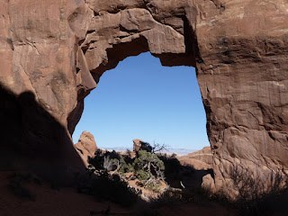


Landscape Arch :- It is only 6 feet at the narrowest point. A portion at the top corner collapsed a few decades back. One never knows how long some of these arches would continue to exist. However, new ones are being formed at about the same rate probably slower than that of existing ones being destroyed by human and natural causes.


The remnants of the Wall Arch are just beyond the Landscape Arch. The terrain becomes really steep beyond the Wall Arch and continues right upto the Double O Arch.

Partition Arch


Navajo Arch


Double O Arch
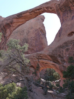


Dark Angel : A climber made it to the top just before I reached this point. His screams of delight and accomplishment could be heard from a distance in the desolate land.


Private Arch : This arch is along the Primitive Loop trail, back to Landscape Arch from Double O Arch. It was an extra 1.5 mile trip back along this trail. I had run out of water and preferred to take the trail I had come along.


By the time, I was back at about 2:30 pm to the parking lot in Devils' Garden, I had hiked almost 6 miles and was extremely tired. It was time for quick snack and a brief rest. The plan was then to get to Delicate Arch, the most famous of the Arches in the park. It is an ideal point to be at sunset.
http://picasaweb.google.com/ahire.parag/ArchesNationalPark?authkey=Gv1sRgCMzIjYij6oWVrgE&feat=directlink