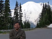
Friday, July 24, 2009

Trip to Nainital, Mussoorie and Jim Corbett National Park with Kesari Tours :- Day 3

21st May 2009 :- The day began with breakfast which as usual was one with plenty of variety. Quite a few in the group had become sick possibly due to the food eaten at the restaurant at Haridwar. A few indicated as watermelon or vegetable salad as the cause of the problem.

Our bus then left for Kempty Falls, a popular tourist attraction which was about 8 kms from the hotel. It is on the way down from the hill station on a side opposite to from where we had arrived. Kempty Falls was developed by the British. It actually stands for 'Camp-Tea' and was a location where the British would have tea-parties. It is a series of five cascades and gives the appearance of water jumping and playing on the rocks before falling down. Recent development however has resulted in construction of entertainment zones at each of these five spots for commercial purposes. The Yamuna river is further down the hill along this road.


The bus was parked a short distance away from the point where one goes down to the falls. This is one of those places where one takes a trolley to get down to view the attraction. The spot where we headed too was one where a pool had been constructed. The area had been opened up for swimming, allowing visitors to get right to the bottom of the 40 foot of the fall. Nihar and I entered the pool. Needless to say the water was amazingly cold. Nihar took about 10 minutes to get used to the cold water. He kept jumping around in the water and clung to me like a monkey trying to avoid the cold water. When asked to leave the pool, he was not interested. I then got a float for him so that he could get into the tube and this allowed me to drag him around the pool. A couple of times we ventured close to the fall, right below one of the off-shoots, away from the main area where the force of the water was the greatest. Watching Nihar and me playing these pranks was quite a lot of fun for spectators standing on the bridge. The water wasn't too deep but there were quite a few rocks below.


We then clicked a few photographs in traditional Garwahli clothing. Nihar and Varsha looked pretty neat in these clothes.

A minute or two by the trolley took us back to the top of the hill. The bus was parked at least 1/2 a km away. We had lunch at the hotel and then we had time for rest. Nihar and I, enjoyed a game or two of table tennis. In that time Nihar played just one or two shots on the table, the rest were straight uppish shots heading for the ceiling, the walls or at times my face. I rented the pool table for an hour just and was done just in time for tea time.

The bus then took us to Gandhi chowk in the heart of Mussoorie. A 10 minute ride by a human cycle rickshaw took us to the bottom of Gunhill point. A ride by a rope way took us to the top of Gunhill point. This place provided a good view of Mussoorie, Doon valley. It was a bit cloudy and the views were obscured a bit. This particular cable car has been around for the last 30 years and is one of the first in India.


Once down we walked around on the Camel back road and then headed back to the center of town by the cycle rickshaw. We hardly did any shopping as we were told Nainital is a much better place to be shopping for typical goods at such a hill-station.

Dinner was preceded by a a short birthday celebration for one of the tourists (a research scientist) travelling on a bus other than ours but a part of the same group. The DJ went on mostly by himself, as not many participants danced to the tune of music.

Kesari Tours and their guides ensured that all passengers were well fed, kept busy and entertained at all times of the day. I was not too impressed by the scenery so far and was waiting for an getting to Jim Corbett National Park. Nihar and I, both had great expectations from this tourist attraction.

Thursday, July 23, 2009

Trip to Nainital, Mussoorie and Jim Corbett National Park with Kesari Tours :- Day 2

20th May 2009 :- We checked out of the hotel after breakfast. Being Day 2 there was some increase in communication between fellow passengers. The first place we visited was Gangaghat at Haridwar. The plan was to visit this in the evening on the first day but the road trip the previous day was a delayed one.

The river Ganges enters the Indo-Gangetic plain of North India for the first time at Haridwar. Haridwar is also the entry point for the Char Dham yatra (of Badrinath, Kedarnath, Gangotri, Yamunotri). The river water was ice-cold even in the month of May. Rather than taking a dip in the river we decided to be safe and just waded through the water on one of the ghat steps close to the river. The area close to the river and the river water itself is pretty unclean. Idols of deities could be seen popping up from the water at several places. A dam constructed beyond the ghat ensured that there was plenty of water close to the ghat.

Not many amongst us could spend a whole lot of time here. A few dared to take a dip and also got some mantras chanted by one among many brahmins present at the ghat.

We then headed to Hrishikesh which is about 25 kms from Haridwar. The first sight of forest cover could be seen along this road as we went up the mountain range. The main attraction here is Laxman Zhulla. It is believed that Laxman crossed the river Ganges at this particular point by constructing a jute rope bridge. That kind of bridge was reconstructed over the years to be replaced by an iron-rope suspension bridge which was eventually replaced by the strong bridge that stands today. The river at this particular point is surprisingly quiet even though it flows through a hilly area. This place is located in the Garwhal region of Uttarakhand.


We visited quite a few temples before heading to Chotiwala a restaurant famous for its food and also for a person with a Choti sitting at the entrance of the restaurant. The food here is strictly vegetarian but was pretty good. The weather was hot and a good meal was welcome after some sight seeing.


We had walked over the Laxman Zhulla towards the North, and then came back by a boat where we got an oportunity to fill a small plastic can with Ganga-jal. The bus then headed to Mussoorie which is aout 120 kms away and about 3 hours away in terms of time. As the bus went past Haridwar, the first instance of stomach sickness hit a girl (last name Vaidya) who was sitting right next to me. Fortunately, I was not sprayed by her vomit but neverthless there was quite some mess created. The road to Mussoorie is a 34 km ghat starting at Dehradun. Kesari guides offer tablets to make things easier for individuals who get affected by winding roads. After the incident with the girl, Nihar seemed pretty confident that such roads do not affect him. He had formed a good bond with a lad (Bunty), a year or two older than him. They had fun playing games along with a small girl named Shamalee. After getting through most of the ghat Nihar started feeling uneasy. Just as we reached the hotel Nihar could not control his stomach sickness any more and finally relieved himself by vomitting. This had to happen after all the loathing about never getting affected by ghats :-)

Mussoorie is located at a height of 6600 ft. The forest cover was pretty dense and sights down the ghats were pretty. Surbhee Resorts which is about 7 km away from the center of Mussoorie, is down the ghats, in a direction opposite to Dehradun. The resort is extensive with townhomes situated on the hill slope. There were entertainment facilities in the form of a billiards table, ping pong table, other games etc.


It was tea time, followed by checkin. The rest of the evening was free time for all to rest. The rooms seemed a bit unclean, possibly due to lack of constant visitors. The television was not that good which meant I could not watch IPL with continuity. There also was an intermittent power cut which was complemented by constant talk by Varsha about me watching cricket. Nihar and I spent some time playing ping pong. Nihar went after the ball as if he was playing cricket, always interested in sending the ball in orbit for a six. A few youngsters (probably visting from Delhi) had occupied the table for long and it took a while to join them for a game.

Dinner was in an exclusive room where a DJ had been arranged. The first program organized by Kesari guides was one of introductions where families took turns to talk about themselves, their background and interests. This broke the ice and many groups started communicating among themselves in groups at the dinner tables. Quite a few people danced to the tune of Hindi film songs. The groups included the young and old. Varsha and Nihar enjoyed themselves to the tune of music. Unlike me, Nihar can dance for sure but needs a lot of coaxing to get started. Dinner and lunch often included a soup and non-vegetarian varieties were on offer for those that like to have a go at it.

Wednesday, July 22, 2009

Trip to Nainital, Mussoorie and Jim Corbett National Park with Kesari Tours :- Day 1

19th May 2009 :- We took an early morning flight from Pune to Delhi by Spice Jet Airlines. We were informed a day earlier that the flight would depart 30 minutes earlier than what we originally knew it would. My biggest concern for a trip in India was the water (and the possibility of pathogens/parasites) in comparison to the heat one would experience in the height of summer in North India. The airport in Pune seemed to have undergone quite some change in comparison to my last visit there in 1998.


For a change, I had company in the form of family members Nihar and Varsha. Kesari Tours is known to be a family oriented tourist company catering to the varied age of individuals, party to the tour. I was impressed by the Delhi domestic airport which I had visited on my last domestic flight in India. A 45 minute taxi ride brought us to Nizamuddin railway station but it also provided a glimpse of the conditions in summer for Delhi via a taxi without an A/C.


It was then more than an hour of wait in a parked bus as passengers from various parts of Maharashtra gathered, after having arrived by different means (flight or rail). Lunch at the GG's Fast Food place was not impressive. An hour's drive brought us into Uttar Pradesh (UP). Needless to say a speed of 40 kmph was the best one could go. There were quite a few interesting families in the bus on this trip. A particular section would get annoyed every time the driver blew the horn to warn approaching vehicles or the horde of pedestrians on the highway. The driver too fancied blowing the horn with elan bringing even more frustration to certain annoyed passengers. Usual situations where certain individuals felt the volume of music was too low or a bit high just had to occur. The highway in UP had a long stretch with a divider in the middle of the road. There were other stretches that were under construction resulting in two way traffic on just one side of the road. At other times vehicles went along the wrong side with complete disregard of the fact that the traffic was on a two way road. UP being the most populous state of India, there was hardly about 2 to 3 kms of stretch of road without some traces of civilization beside the roadside. I was among the very few passengers who could not sleep in the moving bus after lunch.

After about 120 kms the bus halted at a beautiful roadside restaurant for a snack break.

Very soon we entered Uttranchal with about 80 kms to get to Haridwar. The total journery was to take about 5 hours and there were easily about 2.5 hours to go. The next stretch of road was one where there was some forest area beside the road. One could see a few monkeys getting to the highway to pick up scraps of food dumped from moving vehicles.

It was close to getting dark when suddenly out of nowhere a dust storm came across and soon changed to heavy rain. The bus was one without a good front windshield wiper. The ferocity of the wind and dust caused many a vehicle to halt by the roadside. The bus driver seemed

skilled and dared the dust storm and rain by continuing to drive. This impressed many a young kid on the vehicle. Nihar got himself introduced to a few kids sitting at the back of the vehicle. The kids entertained themselves by means of their childish talk and games.

With vehicles slowed down on the road, coupled with a few fallen trees and no lights by the roadside the progress of our vehicle was slowed down. As we got closer to Haridwar there was no rain around and we also had a few lights. Nihar was getting impatient after having spent about 6+ hours in the bus at a stretch only with a brief halt.
We made it to Haridwar and checked into Hotel Khanna palace where we had dinner. Ever since I had arrived in India, there was pretty good food to be had. Being in North India one knew the kind of food to expect. However, the food at this particular place was not too good but there was plenty of variety to be had. Vegetarian as well as non-vegetarian dishes were available as per the taste of all. Our stay at the hotel was for a single night.
The next day, we were supposed to check out of the hotel, visit Haridwar and travel to Mussoorie.

Monday, July 20, 2009

Mount Rainier National Park (Day 3)

After a good night's sleep I did manage to get ready to leave early in the morning on Day 3, the final day of the trip. My flight back was from Seattle at 7:45 pm PST. I checked out of Paradise Inn at 7:00 am in the morning.

Sunrise, located at 6400 ft above sea level is the highest point that can be reached by vehicle at Mount Rainier National Park. Mid-summer is the time to visit this area due to the abundance of wild flowers amongst Meadows next to the Vistor Center. Emmonds, Winthrop and Carbon glaciers are the three most prominent glaciers located on the North side of the mountain and appear close from the look out points at Sunrise. Being on the South Side, I had to head South East and then to the North towards the North East entrance to head West and get to Sunrise Vistor's Center.
After almost three hours I made it to Sunrise. My first view of Mount Rainier from this area was at a view point with a vacant parking lot, amidst some cloud cover. The views were pretty in all directions except for the lack of bright sunlight. I gladly obliged to click some photographs for an old Japanese couple who were delighted by the scenery.


The visitor's center was closeby. The brief halt allowed me to charge by camera battery to a level enough to last me the rest of the day. A look through the telescope at the visitor's center provided an upclose glimpse of the expanse of the glaciers at the top. 5 hikers were visible below the area around Liberty Cap that is located at 14122 ft.

I went on a short hike to a ridge behind the Visitor's center and then to a view point of the Emmons Glacier. After an hour of hiking it was time to grab a bite. I had picked up a sandwich for lunch at the gas station at Packwood.


Glaciers, rain forests, miles of trails, a 14 K mountain summit, alpine mountain meadows, waterfalls, a rustic mountain lodge, remnants and traces of volcanic activity, geological history, curvacious roads with everchanging vistas, Mount Rainier National Park has it all. It's truly a source of inspiration as per ones area of liking.
A 2 hour drive brought me to Seattle. I had planned a visit to Space Needle of Seattle. This area is located North of Sea-Tac airport. The outer deck provides views of the city in all directions. Mount Baker and Mount Rainier are clearly visible on clear days.


After a 2 hour of looking around it was time to head to the airport. A quick snack and a short drive South, brought me to the airport and to the end of this memorable trip to Mount Rainier NP in Washington State.

Saturday, July 18, 2009

Mount Rainier National Park (Day 2 - Part II)

July 4th 2009 :- Hike along the High Skyline Trail (.. contd)
The trail descended sharply to an area filled with taller trees and a grassy hillside followed by a steep slope on a hillside. The scenery along this hillside was spectacular. The photographs right below should provide a good idea of the area.


The hike along the slope from this point on was very steep and the snow was deeper. The first part of the descent criss-crossed the hillside but beyond a point it was straight down. A couple behind me decided to put their sack to use. The first person opened up his sack (which after the snack at Panorama Point) was pretty empty. The person then used the open sack as a seat and just slid down the mountain slope at full speed. I stayed away from such heroics and made it down the treacherous slope with a few slips and ankle twists. Fortunately for me, I made it to a comfortable spot without any issues. The snow here was 10-12 feet deep as could be witnessed by tree-tops emerging from the snow at what could be preceived as the bottom of the hill.
The trail then went passed Myrtle Falls that I had come to the previous evening and after 1/2 a mile I was back at Paradise Inn. The 5.5 mile hike had left me pretty exhausted. I had lunch at the eatery and then hit the bed for some rest at the hotel. This is pretty much unlike me but such was the nature of the hike that saw me gain an elevation of 1700 ft.
Within the next half an hour I was back at the visitor's center next to the hotel and witnessed the new movie that the NP Service had introduced about Mount Rainier. These movies make an ordinary NP appear the most spectacular place on earth. Mount Rainier however is very very special and needs no advertisement for one to appreciate its beauty, variety and verdancy.
I then decided to take the Nisqually Vista Trail that heads West to a point where one can witness the Nisqually glacier. The trail is pretty flat except that one goes down a couple of hundred feet as one gets to the vista point.


Back at the visitor's center it was time to have a snack. I also packed a sandwich for dinner. Longmire is located 12 miles down the mountain and is the area one gets to immediately after entering the park. I decided to head down to get to a feel of a different setting of the NP. The area here has huge trees with thick tree cover all over. On the way I stopped at Christine Falls and then went to the head of the trail to Carter Falls. This is a 2 mile round trip that begins by crossing the river over a precariously placed log of wood over the fast flowing river.


The sun sets at 9 am and dusk at the top of the mountain is witnessed even at 10 pm. However, down in the valley it seemed darker than it was due to the high trees. The hike was an easy one going through high thick trees on one side and the Paradise River on the other side. The ascent was only 500 ft but it seemed much more just due to the reason that I was pretty tired as I had hiked almost 7 miles prior to this one. The view of Carter Falls was not that spectacular, as it was shrouded by vegetation and also due to the fact that it was dark in this side of the mountain.
I headed back the car and then back to the mountain top to Paradise. I had the sandwich for dinner in the hotel room and crashed at 9:30 pm. I could only sleep after 10:30 pm or 11 pm. It was an indication of how tired I was. Anyway, the hikes, scenery was worth the effort ....