Monday, July 20, 2009

Mount Rainier National Park (Day 3)

After a good night's sleep I did manage to get ready to leave early in the morning on Day 3, the final day of the trip. My flight back was from Seattle at 7:45 pm PST. I checked out of Paradise Inn at 7:00 am in the morning.

Sunrise, located at 6400 ft above sea level is the highest point that can be reached by vehicle at Mount Rainier National Park. Mid-summer is the time to visit this area due to the abundance of wild flowers amongst Meadows next to the Vistor Center. Emmonds, Winthrop and Carbon glaciers are the three most prominent glaciers located on the North side of the mountain and appear close from the look out points at Sunrise. Being on the South Side, I had to head South East and then to the North towards the North East entrance to head West and get to Sunrise Vistor's Center.
After almost three hours I made it to Sunrise. My first view of Mount Rainier from this area was at a view point with a vacant parking lot, amidst some cloud cover. The views were pretty in all directions except for the lack of bright sunlight. I gladly obliged to click some photographs for an old Japanese couple who were delighted by the scenery.


The visitor's center was closeby. The brief halt allowed me to charge by camera battery to a level enough to last me the rest of the day. A look through the telescope at the visitor's center provided an upclose glimpse of the expanse of the glaciers at the top. 5 hikers were visible below the area around Liberty Cap that is located at 14122 ft.

I went on a short hike to a ridge behind the Visitor's center and then to a view point of the Emmons Glacier. After an hour of hiking it was time to grab a bite. I had picked up a sandwich for lunch at the gas station at Packwood.


Glaciers, rain forests, miles of trails, a 14 K mountain summit, alpine mountain meadows, waterfalls, a rustic mountain lodge, remnants and traces of volcanic activity, geological history, curvacious roads with everchanging vistas, Mount Rainier National Park has it all. It's truly a source of inspiration as per ones area of liking.
A 2 hour drive brought me to Seattle. I had planned a visit to Space Needle of Seattle. This area is located North of Sea-Tac airport. The outer deck provides views of the city in all directions. Mount Baker and Mount Rainier are clearly visible on clear days.


After a 2 hour of looking around it was time to head to the airport. A quick snack and a short drive South, brought me to the airport and to the end of this memorable trip to Mount Rainier NP in Washington State.

Saturday, July 18, 2009

Mount Rainier National Park (Day 2 - Part II)

July 4th 2009 :- Hike along the High Skyline Trail (.. contd)
The trail descended sharply to an area filled with taller trees and a grassy hillside followed by a steep slope on a hillside. The scenery along this hillside was spectacular. The photographs right below should provide a good idea of the area.


The hike along the slope from this point on was very steep and the snow was deeper. The first part of the descent criss-crossed the hillside but beyond a point it was straight down. A couple behind me decided to put their sack to use. The first person opened up his sack (which after the snack at Panorama Point) was pretty empty. The person then used the open sack as a seat and just slid down the mountain slope at full speed. I stayed away from such heroics and made it down the treacherous slope with a few slips and ankle twists. Fortunately for me, I made it to a comfortable spot without any issues. The snow here was 10-12 feet deep as could be witnessed by tree-tops emerging from the snow at what could be preceived as the bottom of the hill.
The trail then went passed Myrtle Falls that I had come to the previous evening and after 1/2 a mile I was back at Paradise Inn. The 5.5 mile hike had left me pretty exhausted. I had lunch at the eatery and then hit the bed for some rest at the hotel. This is pretty much unlike me but such was the nature of the hike that saw me gain an elevation of 1700 ft.
Within the next half an hour I was back at the visitor's center next to the hotel and witnessed the new movie that the NP Service had introduced about Mount Rainier. These movies make an ordinary NP appear the most spectacular place on earth. Mount Rainier however is very very special and needs no advertisement for one to appreciate its beauty, variety and verdancy.
I then decided to take the Nisqually Vista Trail that heads West to a point where one can witness the Nisqually glacier. The trail is pretty flat except that one goes down a couple of hundred feet as one gets to the vista point.


Back at the visitor's center it was time to have a snack. I also packed a sandwich for dinner. Longmire is located 12 miles down the mountain and is the area one gets to immediately after entering the park. I decided to head down to get to a feel of a different setting of the NP. The area here has huge trees with thick tree cover all over. On the way I stopped at Christine Falls and then went to the head of the trail to Carter Falls. This is a 2 mile round trip that begins by crossing the river over a precariously placed log of wood over the fast flowing river.


The sun sets at 9 am and dusk at the top of the mountain is witnessed even at 10 pm. However, down in the valley it seemed darker than it was due to the high trees. The hike was an easy one going through high thick trees on one side and the Paradise River on the other side. The ascent was only 500 ft but it seemed much more just due to the reason that I was pretty tired as I had hiked almost 7 miles prior to this one. The view of Carter Falls was not that spectacular, as it was shrouded by vegetation and also due to the fact that it was dark in this side of the mountain.
I headed back the car and then back to the mountain top to Paradise. I had the sandwich for dinner in the hotel room and crashed at 9:30 pm. I could only sleep after 10:30 pm or 11 pm. It was an indication of how tired I was. Anyway, the hikes, scenery was worth the effort ....

Thursday, July 9, 2009

Mount Rainier National Park (Day 2 - Part I)

July 4, 2009 :- The park ranger had referred to Panorama Point (located at 6800 ft) as a point to go to in order to view the other big volcanoes that can be seen South of Mount Rainier. I decided to take the trail to Panorama Point via the High Skyline Trail which is a 5.5 mile round trip allowing one to gain an elevation of 1700 ft that takes an average of 4.5 hours to complete. The trail begins at the parking lot at Paradise Inn. I began early in the day around 9 am after having breakfast at the small eatery at Paradise Inn.
A bus belonging to Rainier Mountaneering Inc. stopped right then with more than a dozen climbers going along the same hike. The trail begins through mounds of soft snow with areas that have exposed paved pathways. The snow was soft and hence although a bit slippery allowed one to get a grip even after a slight slip. The first 0.82 miles took one to Alta Vista point which is a rigde that offers views of the twin peaks to the South. A brief halt allowed me to get some rest and click a few photographs.


A hiking trail then takes one towards the Skyline trail but for some reason I decided to follow two individuals who went straight up towards the ridge. A few climbers with snow boots, crampons, ski poles took the hiking trail and seemed to have been stuck in sticky area a short distance away. The path straight up the ridge seemed pretty steep, which under normal circumstances I could have hiked to, with ease. The snow however made things difficult and it took some doing to get to the top of the ridge.

The next mile to Glacier Vista (located at 6336 ft) was pretty easy except for a few patches of snow. 7 out of 10 hikers were all geared up to go beyond Panorama Point to higher areas through Muir Snowfield that stretches from 7000 ft to 10000 ft. It is a permanent field of snow, ice and rock outcrops. In case the weather deteriorates crossing the Muir snowfield can be disastrous. In case of fog or clouds one is advised to desend back to Paradise rather than continue to head towards the top of Mount Rainier. On crossing the snowfield one gets to Camp Muir that can accommodate a substantial number of hikers for an overnight halt. The first clear view of Mount Adams, Mount Hood and Mount St Helens (the one that erupted recently in 2006) was seen from this point. The top of Mount Rainier appeared closer but is was still amazing 8000 ft higher up.


Panorama Point is 500 t higher and just about 0.68 mils away from Glacier Vista. The area for some reason was devoid of snow with patches of open land and a few meadows around it. There was an open area with rocks and an ocassional bench allowing hikers to rest and have a snack. I had left my snack back at the hotel. I was carrying my bulky camcorder, the digital camera, a warm dress (that was actually not required despite the snow) and a bottle of water.


The Skyline trail then continues over a small hill 300 ft higher up from where one can proceed higher to the Muir snowfield. The high Skyline trail however traverses along that height across the mountain and slowly descends long the mountainside. The area had few patches where the snow had melted away exposing the first few patches of meadows. Along the way was a sno covered area but fortunately the trail passed higher over that area and descended slowly along the hillside.


Monday, July 6, 2009

Mount Rainier National Park (Day 1)

July 2nd, 2009 - Mount Rainier National Park (MRNP) is less than 1oo miles away from Seattle, Washington. Having arrived at Seattle, late the previous night, I left for MRNP only around 9 am. Mount Rainier is an active volcano, 14411 ft high (2.7 miles) and thus the highest and the third most voluminous one in the Cascade Mountain range. The Cascade range spreads from Washington to Norther California, along the West Coast. It is the most glaciated peak in the contiguous US and has 26 different glaciers around its periphery. The summit has two craters each about 1000 feet in diameter. I approached the park from the North East entrance.
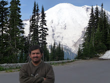
Having left straight from office the previous night, I had to buy a pair of good shoes and some warm clothes on the way. The first full view of the magnificent mountain was seen right after the entrance. The glaciers towards the North side are quite expansive and have not been shrinking as rapidly as some of the others.

Cayuse Pass (4694 ft) and Chinook Pass (5432 ft) have pretty good views. Tipsoo Lake along highway 410 was frozen and seemed to be just begun melting in early summer.

I had not received a park map and unintentionally moved along that way towards the East and out of the park. The drastic change in elevation and vegetation gave me quite a warning but the road seemed to be heading South. Having lost 30 minutes and much more ($), due to this mishap I returned back and checked with a ranger about the right directions. The trip seemed to have begun on a wrong note. More was to follow, as the shorter route to Paradise was closed due to bad road conditions following the winter damage. This was to cost a further 2.5, hours as I had to head 25 miles South to Packwood , then 23 miles West to Ashford and 12 miles to Paradise along curved roads. A quick stop at a gas station at Packwood allowed me to fill up gas (I was not open to any more disasters), grab some food and head ahead.
The area around Longmire at the entrance has National Park Inn and a thickly forested area with a camground or two. Along the way are Carter Falls (2.2 mile round trip from the road), Christine Falls and Narada Falls.


Carter Falls


Christine Falls


Narada Falls


One then crosses the Nisqually river, on a high bridge along a wide river bed that once carried lahar (volcanic slushy material) at the time of the last eruption more than a century back. Only a century back the Nisqually Glacier was way down, closer to the bridge and is hence one that has been receeding unlike any other glacier on the mountain.
A few stops at viewpoints along the way then took me to the Paradise Inn located at 5400 ft just at the base where the steep 9000 ft climb to Mount Rainier begins. After having checked in at the hotel, I went along a short 0.5 mile trail to Myrtle Falls. The area was more or less completely covered in snow (soft). I was told that only the last 10 days had opened up the paved paths in patches. The views in all directions were fantastic and trails in snow were certainly something that added to the thrill.


A light dinner at Paradise Inn, was followed by a 45 minute Evening program by a park ranger. It had been a while since I had experienced sunset at 9 pm and dusk at 10 pm. Although, not too tired I had to call it a day, since I knew what the plan next day was going to be ....


http://picasaweb.google.com/ahire.parag/MountRainierNPSeattle?authkey=Gv1sRgCKSYyuXylJ2kxgE&feat=directlink