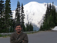
Sept 7th , 2009 :- The hike on the previous day was tiring but even then I managed to get started early at about 8:30 am. The plan for the day was to drive the 48 mile distance through the park along CO-34 and exit the park at the Kawuneeche Visitor Center on the Western side.
This time, I entered the park from the Fall Visitor Center on the East. The views of the meadows from Sheep Lakes were pretty enticing. Beyond this point is the Old Fall River Road, a distance of 9 miles that winds its way up to Alpine Visitor Center. It is a dirt road and although I was tempted to drive along, I decided to avoid it since getting into trouble with a problem with one of the wheels could have caused substantial delays.
I then headed along CO-34 without any halts and made it to Medicine Bow Curve, that is just beyond the Alpine Visitor Center. The road from here drops down over the mountains. A short distance away is Milner Pass that goes through the Continental Divide. Poudre Lake on the North feeds a river system that eventually connects to the Mississippi River than drains into the Atlantic Ocean. Beaver Creek, just to the South feeds the Colorado River that empties itself into the Colorado River. A guide sitting there made it a point to draw the attention of children to this interesting fact. With a few halts along the way and enjoying the scenery, I made it across to the Kawuneeche Visitor Center.
I watched a 20 minute movie about Rocky Mountain Park. The movie was good and informative but unlike some of the other movies that try and depict the park as "the place" on earth this one seemed pretty modest about its message. This also seemed like an old production and probably needs to be replaced by a newer version. I munched on a few snack items and spent time around the visitor center in order to catch the movie at 1:15 pm about the Colorado River. This mighty river originates within the park boundary and flows pretty close to CO-34 through this part of the valley. It was a lengthy movie, but I was reluctant to leave until it was over.
I started at 2 pm and decided to hike to a waterfall named Adams Falls that was close by next to Grand Lake. Grand Lake and Lake Grandby are two lakes that the Colorado River flows through and are close to each other and also pretty huge in size, the latter being the larger of the two. Adams Falls was just 0.3 miles from the trailhead. Knowing, I had to get to Denver at about 5 pm I made it to and back from the falls in quick time. I had been forewarned about the traffic slowing one down on the way as one gets close to the city.
On the way back the 46 miles distance along CO-40 prior to Idaho Springs turned out to be the one where progress was the slowest. Traffic down the hill had a single lane and if you have a slow moving truck ahead of you, you are done. Worse was to follow at US-70 where traffic was crawling at speeds of about 15-20 mph. Just South of Idaho Springs is Mount Evans located at a height of 14260 ft above sea level and one can drive all the way to the top. Had I made it quick all along during the day I just might have been able to drive to the top of this mountain.
I did make it close to Denver a little after 5 pm but the airport was ahead and almost 12 miles away from the freeway. By the time I dropped the rental car and made it by a bus to the airport, there were only about 35 minutes left for the flight to depart. Since it was less than 45 minutes for the flight, I was not in a position to check in the luggage. I made it to the gate of departure 5 minutes prior to the flight departure time and was among the last dozen odd individuals to board the plane.
Rocky Mountain National Park is the epitome of a visit to the mountains in North America. It was a wonderful experience and as usual the time available at hand proved to be not so adequate. This visit was certainly one to be cherished, the drive along Trail Ridge Road and the hike to 'Sky Pond' being the highlights of the time spent here.
Subscribe to:
Post Comments (Atom)

No comments:
Post a Comment