Nov 14, 2008 :- Water and ice, extreme temperatures, and underground salt movement are responsible for the sculptured rock scenery of Arches National Park. There are about 2000 cataloged arches ranging from a 3 foot opening to the Landscape Arch, the longest of them all, measuring 306 feet across.
The day began driving to the northermost portion of the park going by the Courthouse Towers.


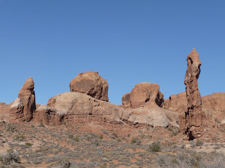
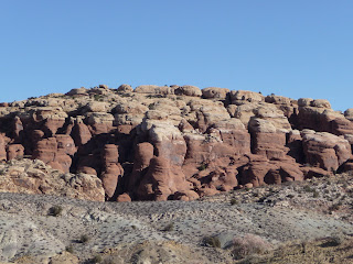
One then passes through Rock Pinnacles constituting the Great Wall with Petrified Dunes on the other side of the road.

The road takes you down into a valley known as the Salt Valley. The formations beyond the road are known as the Fiery Furnace.

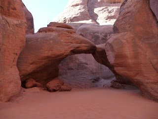
Sand Dune Arch and Broken Arch are a short hike (1.6 miles round trip) away beside the park road.
It was then time to take a short stop at the Skyline Arch, one of the spots to be at sunset.


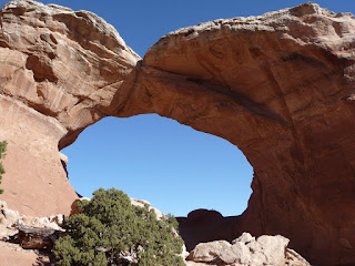
The Devils Garden trail takes one to the largest concentration of arches in the park. It is a 4.2 mile round trip along that trail, with other byways making it about 7.2 miles round trip. The hike takes one through rugged, rocky terrain with short steep slopes up and down. An arch known as the Wall Arch collpased recently in August of 2008.
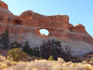
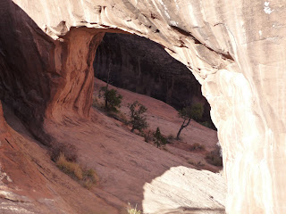
Tunnel Arch
Pine Tree Arch
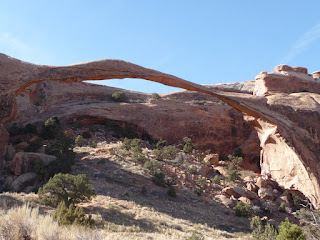
Landscape Arch :- It is only 6 feet at the narrowest point. A portion at the top corner collapsed a few decades back. One never knows how long some of these arches would continue to exist. However, new ones are being formed at about the same rate probably slower than that of existing ones being destroyed by human and natural causes.

The remnants of the Wall Arch are just beyond the Landscape Arch. The terrain becomes really steep beyond the Wall Arch and continues right upto the Double O Arch.
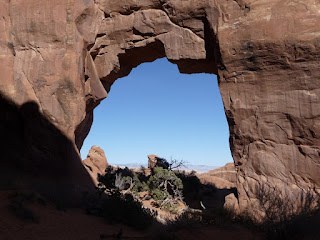
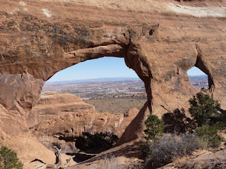
Partition Arch
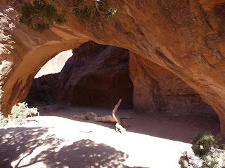
Navajo Arch
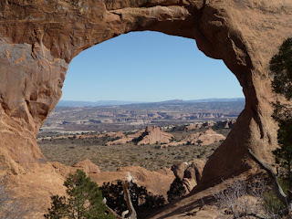
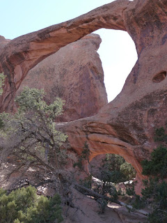
Double O Arch

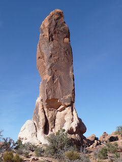
Dark Angel : A climber made it to the top just before I reached this point. His screams of delight and accomplishment could be heard from a distance in the desolate land.
Private Arch : This arch is along the Primitive Loop trail, back to Landscape Arch from Double O Arch. It was an extra 1.5 mile trip back along this trail. I had run out of water and preferred to take the trail I had come along.
By the time, I was back at about 2:30 pm to the parking lot in Devils' Garden, I had hiked almost 6 miles and was extremely tired. It was time for quick snack and a brief rest. The plan was then to get to Delicate Arch, the most famous of the Arches in the park. It is an ideal point to be at sunset.
http://picasaweb.google.com/ahire.parag/ArchesNationalPark?authkey=Gv1sRgCMzIjYij6oWVrgE&feat=directlink


