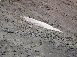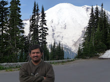


Sept 20th 2008 - On the last trip to Lassen Volcanic National Park a hike to the top of Lassen Peak had to be dropped. The thought of hiking to the top of Lassen Peak that rises to a height of 10457 feet above sea level was too much to resist. We had noticed snow on the mountain top on the last trip in early September last year. We were eager to gather conclusive photographic evidence to negate the lack of belief shown by a few. A year later it was time to accomplish scaling the peak that rises from a base height of 8500 feet above sea level.
Ashish agreed to accompany me on what was the last weekend of summer. We reached the parking lot at the base at around 9:45 am and began the hike at 10:05 am. The temperature was in the high 50's and one had to dress appropriately knowing it gets colder and possibly windier at the top.
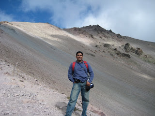
We had set on a hike of 2.5 miles one way and were told that it takes between 3 to 5 hours to make it back. We had heard about air being rarer at an altitude and we experienced it within the first quarter mile. Although the slopes were not very steep it took a while to adjust to the air while ascending the slopes. Frequent stops to catch ones breath, enjoy the nature around you, click some photographs and shoot some video helped get accustomed to challenge at hand. The first level had high coniferous trees on a small plateau. The trees thereafter flatten out as one goes on further up. A group of four hikers talked about the impending proposition and preferred to have a quick brunch just before the ridge had to be scaled. The incline is continuous for approximately 60 % of the entire length. Continuous switchbacks along the the ridge make the hike easier and also improves the views. A view of Lake Helen and the valley towards the south gets prettier as one keeps ascending. At one point one gets to see the glacial slope at few other locations are plaques describing formation of the volcanic mountains in the park and general geology of the area. The second half of the hike is on a barren mountain side with plenty of loose gravel and rock. Ashish was on his first hike to a mountain peak and was going along with relative ease. He used the video camera to good effect describing our progress and clicking photographs all along, at every spot where we encountered something new. The second half of the ascent resulted in rising clouds taking away views towards the north, west and east. We reached a sign that indicated 0.5 miles to go to get to the top. We continued with renewed vigor and made it to the false top. Here is the crater than forced the lava out in 1914 when there was the last eruption. The true top is about a couple of hundred feet higher. the ascent to this small hill is through very loose soil, gravel and rock .
Soon we were at the very top where one can see the survey mark and a communication station that is marked as a high voltage spot. We reached the top in 2 hours without having stretched ourselves and going at a steady pace with short halts along the way up. The first five minutes offered obstructed views with only the south being clearly visible. Visibility got poorer as the clouds shrouded the mountain top leaving a small area towards the south. The devastated area towards the east was clearly visible giving an idea of what could have happened at the time of the eruption in 1914.
It was time to much onto snack while enjoying the good but relatively disappointing views. More and more hikers kept reaching the top compared to the ones we had seen go downhill. It was getting crowded at the top making clicking an unobstructed photograph a difficult proposition. It was getting colder too with the wind catching a bit and the couds getting denser. It was time to head down and make way for the ever increasing hikers. Hikers seemed to range from the young age of 15 to a aging 70 year old. Many seemed challenged but kept trudging along the slopes.
The hike down was more enjoyable and obviously more comfortable and quick. The clouds cleared a bit and so did our minds with the satisfaction of having scaled our first 10000+ ft high peak. We observed the trees closely on the second half down and noticed that these were flatter possibly due to the yearly snow melt along the slopes and earlier destruction by the volcano.
We reached the parking lot at the base in about 1 hr 15 minutes. This concluded a moderate hike in distinct topography . Ashish enjoyed his first hike and is certainly in for more.
Half Dome, Mount San Jacinto and Mount Whitney beckon next. Anybody going? You have one confirmed participant .....
